The Great MisAdventures of David & JoEllen Laurita
Our Fulltime RV Adventures Across America With Toby The Cat
The Road to Our Colorado Ranch
Left Quartzsite March 3 arrived at the MisAdventure Ranch April 21, 2008
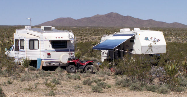
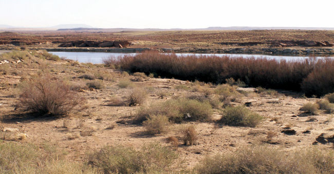
Camped in the desert at Gold Basin
Just south of Lake Mead near Dolan Springs, Arizona.
We left Quartzsite Tuesday, March 25th and traveled through Kingman to get to another gold seeking place. The short adventure north has not been without trouble. First, the Mighty 350 refused to start when leaving Quartzsite, turned out to be damaged battery cables. Later that day, while pulling over to check the load upon reaching I-40, there was a softball size bubble in the sidewall of one of the 5th wheel tires. A quick stop at a tire shop put 2 new tires on the trailer. The Mighty 350 got new tires in Mesa while David was visiting his Mother, so far a very expensive month. The price of diesel fuel is not helping.
Gold Basin, Arizona
March 3 through March 30, 2008
Gold Basin is located in the Mojave Desert just south of the Nevada State line and Lake Mead Recreation Area. It is dark here at night, lots of stars. We can see the glow of Las Vegas to the northwest. It is 25 miles to Dolan Springs, the closest town and post office. The temperature is more moderate for us Mountain People, highs in the upper 70's, lows in the high 30's. We last visited this location in the second year of the MisAdventure back in October, 2006, on an outing with Nugget Shooters, a fun group of gold detectors and miners. There are meteorites here as well that sound off on the metal detectors, David is hoping to find a space rock or two!
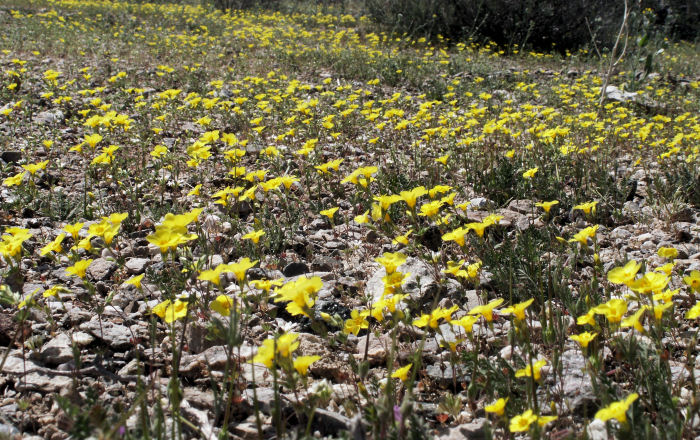
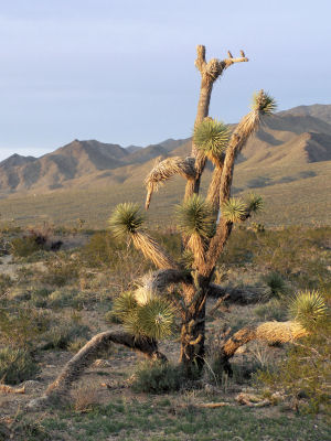
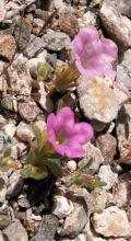
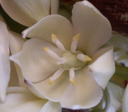
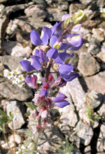
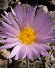
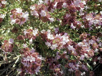
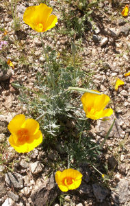
Spring in the desert. Flowers are found everywhere and everything has a green tint. Some flowers are tiny, only 1/4 inch diameter, and some flowers blanket the desert rocks and sand. The yucca catcus are also blooming. There are even Joshua Trees here in Gold Basin. The name Joshua Tree was given by a group of Latter-day Saints who crossed the Mojave Desert in the mid-19th century. The tree's unique shape reminded them of a Biblical story in which Joshua reaches his hands up to the sky to stop the sun by God's command.
|
|
|
|
|
|
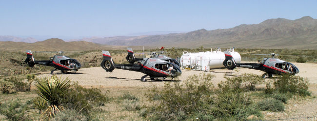
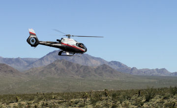
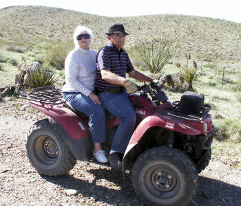
Here at Gold Basin, Maverick Helicopter Tours land and refuel after flying over the Grand Canyon. We all have traveled on the ATV;s to the heliport to watch the planes land, refuel, and take off towards Las Vegas.
Windy day on Sunday, planning to leave Monday. No gold or meteorites found this trip.
Winslow, Arizona
March 30 through April 5, 2008
View from our camp on Clear Creek Reservoir at McHood City Park, about 5 miles from Winslow.
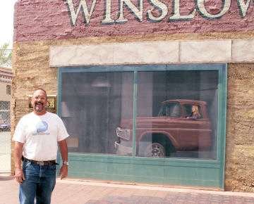
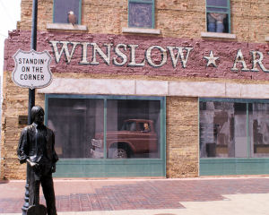
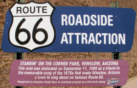
 The "Standin on the Corner" Park, located in downtown Winslow, is "The Corner", made famous by the song "Take It Easy". Written by Glenn Frey and Jackson Browne, "Take It Easy" became The Eagles first hit single in the 70's, and peaked peoples interest in Winslow. The verse "Standin' on a corner in Winslow, Arizona," draws visitors from far and wide to stand on the famous corner. The "Standin' on a Corner" Park is located in historic downtown Winslow and features a life size bronze statue and a two story mural depicting the story behind the famous song.
"It's a girl my Lord in a flatbed Ford slowin down to take a look at me!"
|
|
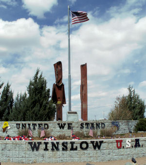
Also located at the east entrance to Winslow is a memorial to the terror attack on the World Trade Center in New York City. Two steel beams salvaged from the rubble were entrusted to the Citizens of Winslow and stand as the centerpiece of the Remembrance Garden. The words "United We Stand" remind the world that we will not fear terrorism.
Great news this week from Arkansas Valley Drilling. Our well at the MisAdventure ranch is in and water was found at 120 feet. Now to get a pump in place so we can have water this summer at the ranch.
Navajo Lake State Park
April 6, through April 21, 2008
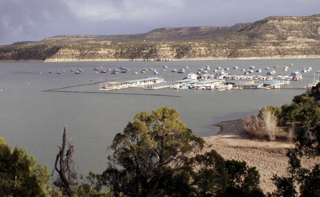
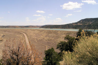
View from our camp at Navajo Lake State Park
Near Farmington, New Mexico.
We moved Sunday from Winslow, AZ traveling to Navajo Lake near Farmington, New Mexico. We are camped at the State Park campground on a bluff above the lake with fine views from our windows. Our yearly camping pass had expired in March, so for $225, we purchased another good through next April. New Mexico has one of the best deals we have found in State Park fees. Camping is allowed for 21 days at one Park before moving on to another State Park. We plan on using our pass this fall and again next spring making this a real deal.
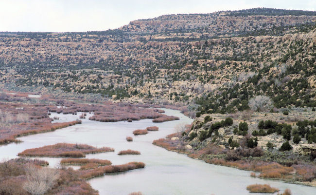
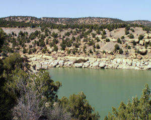
Navajo Lake was formed after construction of Navajo Dam across the San Juan River, which starts in the San Juan Mountains in Colorado, flows south into New Mexico and across the northern edge of the state past Farmington, Shiprock and Four Corners. The dam consists of an earth- and rock-filled structure that extends 3,648 ft across the San Juan River and is 402 ft high at an elevation of 6,085 ft. Construction was begun in 1958 and completed in 1962.
 The waters of Navajo Lake have backed up some 30 miles upstream of the dam along the river plus lesser distances along various tributaries so although all branches are quite narrow, the lake has a considerable area, and is mostly used for boating and fishing. The San Juan River area below the dam is world renowned for excellent trout fishing. Sandstones form the shoreline and adjacent cliffs along Navajo Lake and San Juan River. This is the second largest body of water in New Mexico.
The park is comprised of 2100 acres of land and 15,590 acres of lake surface. Piñon, juniper, mesquite, and yucca cover the hill slopes and mesas surrounding the lake, and various wild flowers and cacti, including cholla and prickly pear, are common. Cottonwood and poplar trees are found along the river valleys. Falcons, mountain bluebirds, quail, dove, ducks, and geese are plentiful. A few bald eagles and peregrine falcons inhabit the area as well. Antelope, elk, and mule deer roam the countryside and a few mountain lions and bear roam the adjacent hills.
We took a drive downriver to Wines of the San Juan winery/tasting room, near Turley, NM, to sample their wares. Tasted many wines and purchased a Blue Winged Olive and a Manzanares Red for our enjoyment. A herd of domestic Elk were at a ranch across the street from the winery.
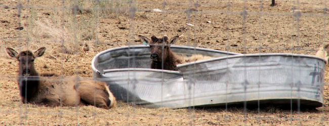
Domestic Elk in a hot tub???
Near Turley, New Mexico.
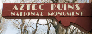
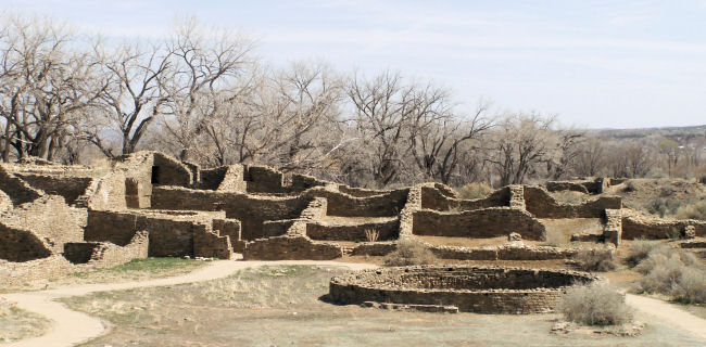
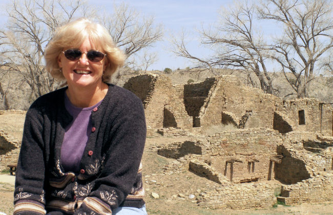
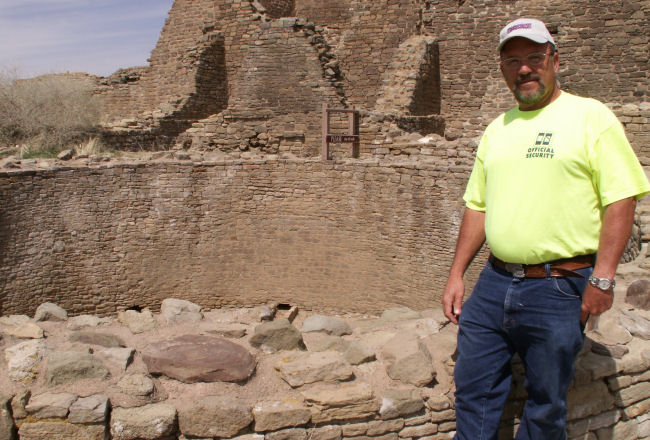
Aztec Ruins
April 8, 2008
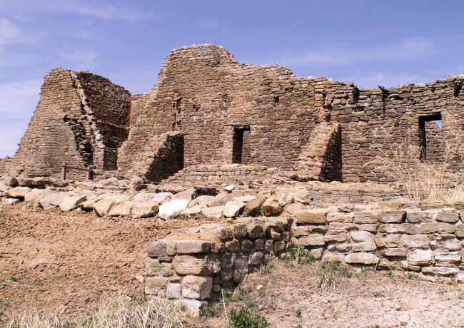
Located in the City of Aztec, New Mexico, the Aztec Ruins National Monument preserves structures and artifacts of Ancestral Pueblo people from the 1100s through 1200s. Anasazi associated with Chaco Canyon to the south built and used the structures, and then Anasazi related to the Mesa Verde region to the north used the site in the 1200s.
Archeologists believe that the 3 story village was constructed about 1100 as a satellite community of Chaco Canyon to the south. Aztec's Anasazi inhabitants were attracted to the valley because of its location and fertile soil.
Its location in the fertile Animas Valley along a large prehistoric road suggests the buildings comprised a ceremonial and trade center. The Mesa Verdeans who arrived 100 years later, built additional rooms, remodeled older ones and used a different type of pottery.
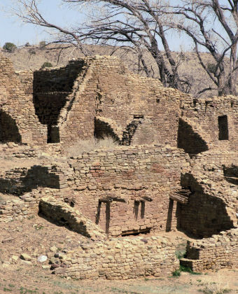 By 1300, archeologists believe that population pressure, climate changes and shrinking natural resources forced the Ancestral Pueblo people to abandon Aztec, just as they abandoned other villages throughout the Southwest. The residents moved away, probably to neighboring areas such as the pueblos of the Rio Grande valley and the present day Hopi and Navajo reservations in Arizona.
The village became ruined, slowly covered by the desert sands and remained unvisited until the mid nineteenth century. The first known rediscovery was in 1859. Years of sporadic looting and several archaeological expeditions followed and not until 1923 did the ruins receive full protection when the national monument was established.
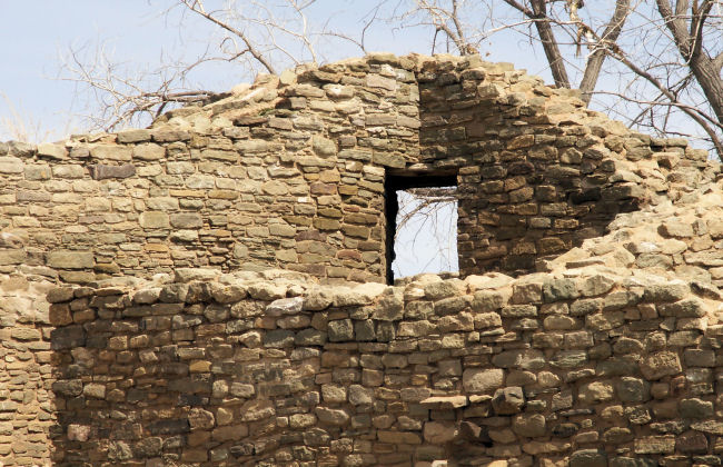
One of the unique doors built into the corners, not normally done in pueblo buildings.
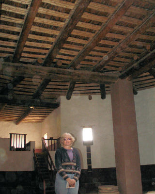
In 1916, the American Museum of Natural History began excavation under the direction of a young, local archeologist named Earl. H. Morris. During the next 7 years, he excavated the major portion of the Western Ruins and returned later to restore and re-roof the Great Kiva.
 The American Museum of Natural History eventually purchased and donated the site to the federal government. Aztec National Monument was established by proclamation of President Warren Harding, Earl Morris became its first custodian. It was designated a World Heritage Site in 1987. Subsequent additions to the site now give it a current size of 319 acres, containing 6 major archeological complexes and 8 smaller mounds. Only the West Ruin and the Hubbard site have been extensively excavated.
Most of the West Ruins and all the rest of the site is closed to the public. We enjoyed walking and crawling on the trail passing through several ground floor rooms which still have complete roofs, into the main plaza and past several other rooms, then into the reconstructed great kiva. The great kiva is almost 50 feet wide, and was rebuilt in 1934. Aztec's reconstructed kiva is the largest structure of its kind in the Southwest.
The site is still considered sacred by many Southwestern tribes.
Our MisAdventures
- The Great Ongoing MisAdventure
- Spring 2008
- The Great 2007/08 Quartzsite MisAdventure
- Fall 2007
- Summer 2007
- Spring 2007
- The Great 2006/07 Quartzsite MisAdventure
- October 2006
- September 2006
- The Great 2006 Northwest MisAdventure
- The Great Caribbean Cruise MisAdventure
Contact
Living Our Life
Neat Things

Lord, let us live with joy in our hearts, knowing you will grant us strength and keep us safe in our travels. Amen